Geology
Ancient seas and continental drift
The rocks underlying the Elan Valley landscapes formed from sediments deposited between 445 and 433 million years ago, in the late Ordovician and early Silurian periods. These geological periods are named after two of the British tribes living in Wales during the Iron Age and the Roman occupation. The territory of the Ordovicii, whose name may mean hammer fighters, included the Cambrian Mountains and the Elan Valley.
These ancient sediments were deposited in a deep sea basin, now called the Welsh Basin. This formed on the edge of the microcontinent of Eastern Avalonia, then near the South Pole, when it split away from the huge southern landmass of Gondwana. Millions of years later the rest of Gondwana eventually fragmented into Africa, South America, India, Australasia and Antarctica. But Eastern Avalonia, which was to become Southern Britain (including Wales), Southern Ireland and parts of north and east Europe, had a different destiny. It was transported northwards by plate tectonic forces to collide with another large continental mass called Laurentia (North America, Greenland, Scotland and Northern Ireland). This collision happened about 425 million years ago at 25 degrees south of the equator, created the continent of Laurussia (the Old Red Sandstone Continent) and united northern and southern Britain and Ireland on its southern margin.
Underwater Avalanches
During its 50 million year journey northwards the Welsh Basin accumulated great thicknesses of mud and sand washed off higher land to the south and east. The sediments mostly piled up on a shallow shelf on the leading edge of Avalonia and built the shelf out into deeper water. Eventually the sediment piles became unstable and cascaded as underwater avalanches down onto the deep sea floor. These currents are called turbidity currents and flowed down the shelf slope to form large submarine delta fans.
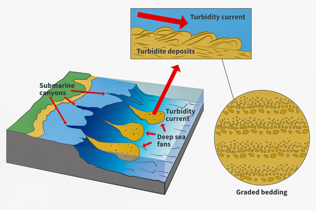
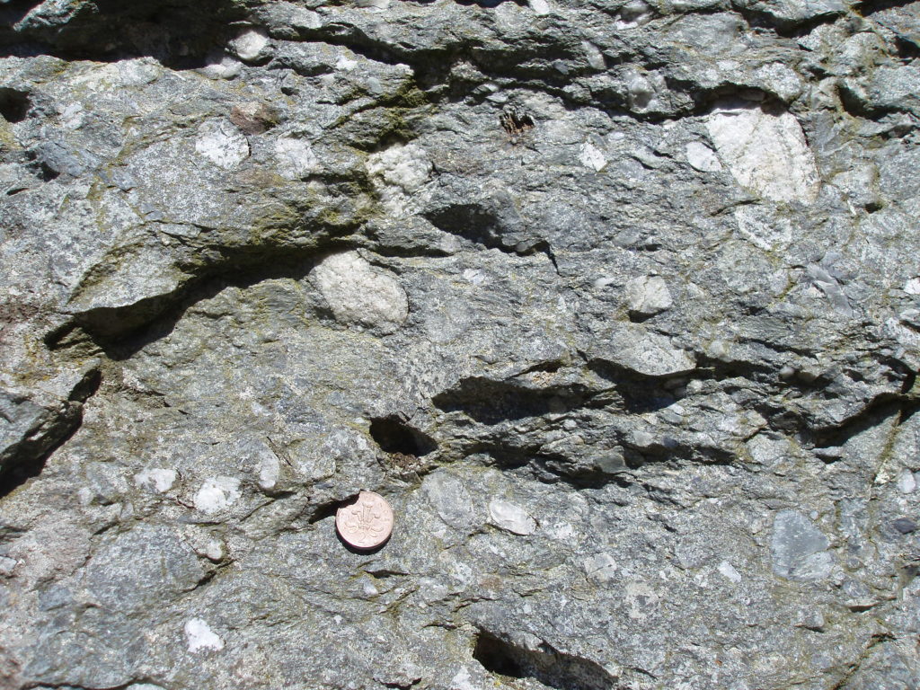
All the rocks in the Elan Valley area were formed from sediment deposited by turbidity currents and are called turbidites. The sediments were progressively buried and compacted by the weight of more sediment above them, some of the water they contained was squeezed out and crystals grew in the tiny spaces between the grains, cementing them together to form rocks. Individual turbidite beds are graded with heavier sediment such as pebbles, gravel, sand or silt at the bottom progressing to the lightest mud at the top. The coarser layers resist erosion better and now tend to form the rocky headlands.
Earthquakes and Submarine Canyons
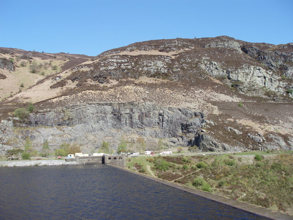
The Caban Conglomerate is a special kind of turbidite which formed as a plastic mass of pebbles, sand and mud. When disturbed, possibly by earthquakes, the mass rushed down the continental slope at very high speed carving a submarine canyon through the finer turbidites. This conglomerate rock is very hard and tough. It forms Drygarn Fawr, the highest point in the area, the high ground south and east of the Visitors Centre and the crags at the northern and southern ends of the Caban Coch Dam, Craig Gigfran and Craig Cnwch. That is why the dam was constructed there, in the narrow valley between the crags. The rock was actually quarried from Craig Gigfran and used as the core material for most of the dams. The quarry is now a car park.
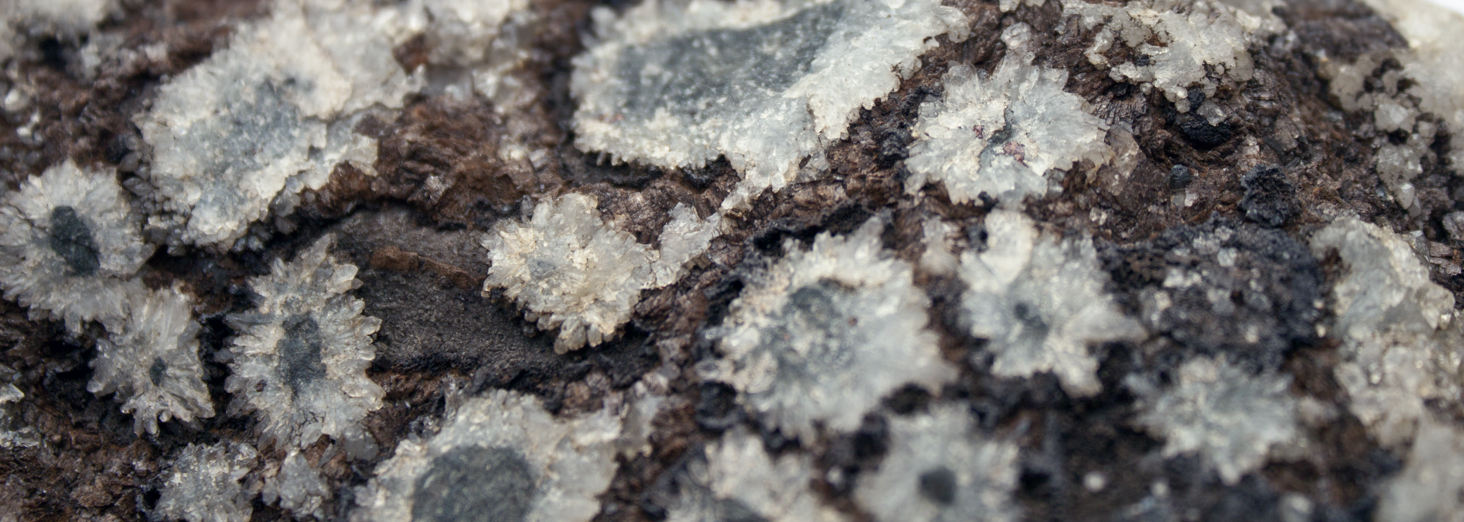
Mineral Riches
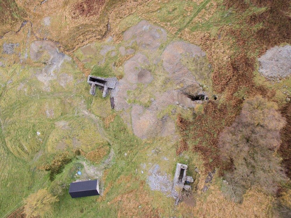
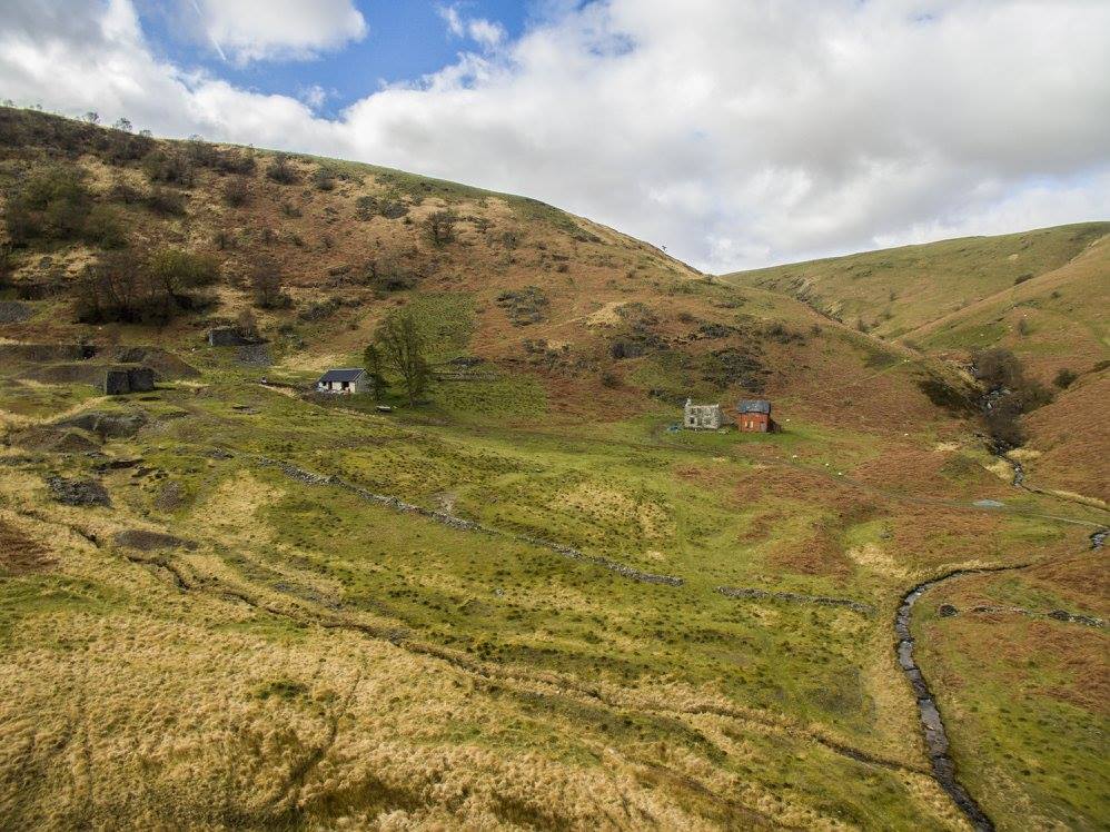
Between about 405 and 390 million years ago the Welsh Basin was gradually squeezed by more tectonic plate movements. As a result the rocks were compressed, forced upwards, folded and fractured. The pressure and heat generated deep within the deformed rocks transformed mudstones into slates and squeezed water from the pores between the grains. This hot, pressurised water permeated through the rocks dissolving out minerals such as lead, copper and zinc. The mineral laden fluids eventually entered the fractures, enlarged and extended them by a process known as hydraulic fracturing, and caused the minerals to crystallise as veins within the fractures. Lead, zinc and copper were mined in the Rhiwnant valley and at Cwm Elan from the late eighteenth and through the nineteenth centuries. The old workings are still visible and can be visited.
The Ice Age
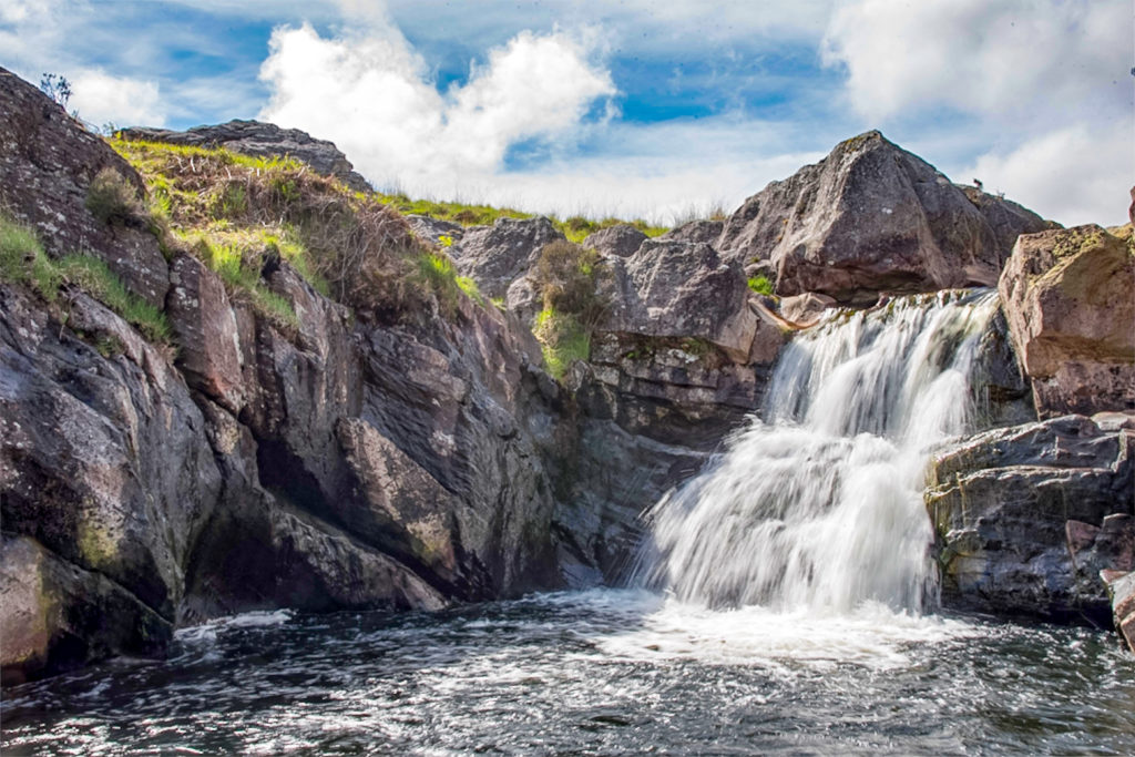
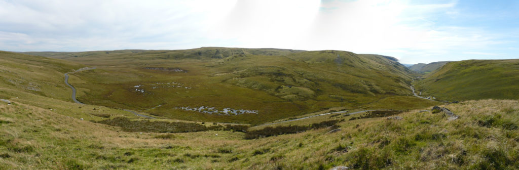
The last Ice Age began 2.6 million years ago. We presume that most of Wales was covered by ice for much of that time but we only have evidence for the last episode. This started 26,000 years ago and finally ended 11,700 years ago. For at least 11,000 years mid-Wales lay under a thick ice sheet which flowed radially outwards, scraping off unknown quantities of rock. The uplands of the Elan area are, for the most part, formed of rocks of similar hardness so the result of the ice action was a dissected upland plateau with only a few higher areas underlain by relatively harder rocks. The many lakes found on the plateau were probably scoured out from locally softer rocks by the passing ice. Ice flowed down pre-existing river valleys but deepened, flattened and widened them to a U-shaped profile, as seen in the Elan & Claerwen valleys.
As the glacier ice melted it created a lake in the headwaters of the Elan at Gors Lwyd resulting in the current unique landscape of lake bed deposits. Where the lake overflowed to the west it added to the earlier ice erosion to form a steep sided V shaped gorge in the upper Ystwyth. Torrents of melt water created further V shaped gorges throughout the Elan and Claerwen valleys. Elsewhere the valley bottoms and sides were smeared with till and ground-up rock left when the ice melted. This now supports the woodlands. Later the deepened valleys made ideal sites for reservoirs.
Most of the flattened higher ground above the valleys is underlain by mudstone and this does not drain well. As a result bog vegetation has flourished, producing thick layers of peat underlying the important blanket bogs. Where the underlying rocks are more porous upland meadows and drier heaths thrive.
The Elan Valley landscape is founded on its geological history.