Explore on Foot
Whether you just fancy a leisurely stroll or a challenging hike,
Elan has something for everyone.
We have selected nine walks for you to discover, whether you would like a leisurely stroll or a challenging hill hike. With 80 miles of designated rights of way, there are many scenic walks and trails to cater for all.
Read the Elan Valley Countryside Code:
Look after yourself – come prepared
Leave all gates as you find them
Stick to the designated rights of way
Due to roaming livestock, keep all dogs on leads or under strict control
Take your litter home
No swimming or boating
No overnight parking or camping
Do not light fires or have BBQs anywhere on the Estate
Leave all plants for others to enjoy
Fishing is by permit only
Stay Safe
Please be aware that the uplands can present significant challenges – the terrain may be difficult and the weather can deteriorate rapidly.
We strongly advise that if you aim to complete any of these walks that you ensure that you have an Ordnance Survey map, a compass, and the ability to use both. Please note that mobile phone reception is extremely limited in the Elan Valley and should not be relied upon. For suggestions on what to carry with you on a mountain walk we would advise the following:
- Map
- Compass
- First Aid kit
- Hat & Gloves
Waterproof clothing
- Sturdy footwear
- Torch
- Whistle
- Plenty of food and drink
Cnwch Wood
Start: Elan Valley Visitor Centre
SN 92797 64640
Distance: 1 Mile
Difficulty: Multi-Access
This gentle walk is well-surfaced meaning it is suitable for pushchairs and wheelchair users, though some assistance may be needed. The walk should take around 30 minutes.
Elan Valley Trail
Start: Rhayader
SN 96635 67784
Distance: 9 miles
Difficulty: Multi-Access
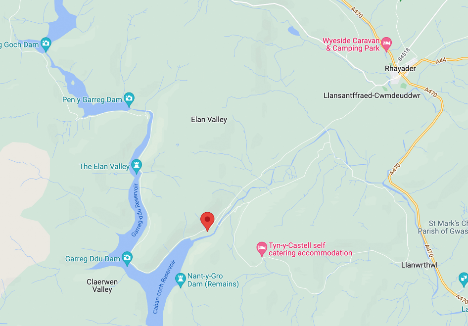
The Elan Valley Trail is a linear path following the line of the old Birmingham Corporation Railway. The trail starts in Cwmdauddwr, just west of Rhayader and finishes 13 km (9 miles) further up the Elan Valley at Craig Goch Dam.
The purpose of the trail is to improve access to the Elan Valley and its countryside for people of all abilities. The trail between Craig Goch and Pen y Garreg is classed as a bridleway. Between Pen y Garreg and Rhayader however the trail is a permissive route agreed by the landowners, Dŵr Cymru Welsh Water, Radnorshire Wildlife Trust and Powys County Council and does not follow a right of way.
The trail is open for use by walkers, cyclists and horse riders. As on bridleways, cyclists and horse riders are required to give way to walkers and the less-able.
Please see the map for the official diversion that follows the road from Penbont to Craig Goch for 4.5km/2.7 miles.
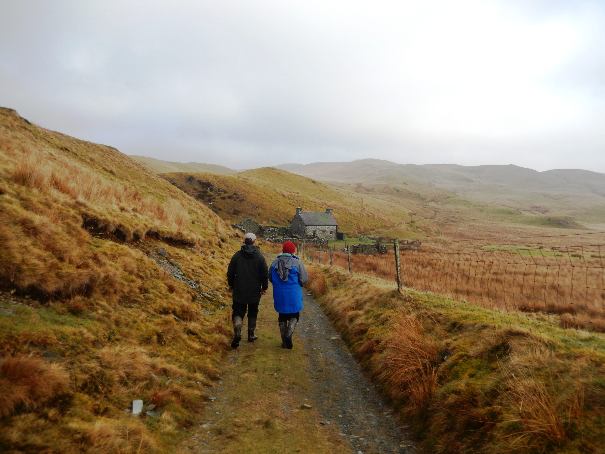
Nant y Gro
Start: Elan Valley Visitor Centre
SN 92797 64640
Distance: 3.5 miles
Difficulty: Moderate
There are steep climbs of 40 metres up steps and 140 metres over 0.8 km. The walk should take around 2 hours. Great views of Caban Coch reservoir to Garreg Ddu viaduct.
Penbont Woods South
Start: Penbont Car Park
SN 91491 67309
Distance: 0.6 mile
Difficulty: Moderate
There is one climb of 35 metres from the bottom to the top of Pen y Garreg Dam via a flight of steps. This walk should take around 30 minutes.
Penbont Woods North
Start: Penbont Car Park
SN 91491 67309
Distance: 0.6 mile
Difficulty: Moderate
A short woodland walk in front of Pen y Garreg Dam. It is a mixture of grassy and gravel paths, with a short descent via a flight of steps. This walk should take around 30 minutes.
Garreg Ddu Reservoir
Start: Llanerchi Car Park
SN 90927 63894
Distance: 6.5 miles
Difficulty: Moderate
There are no significant climbs, however some areas are wet underfooot and the path through the wood is narrow in places with exposed tree roots. The walk should take around 3 hours.
Gro Wood
Start: Llannerch y Cawr Car Park
SN 90074 61632
Distance: 4.5 miles
Difficulty: Moderate
There is a steady climb of 170 metres over 2.5 km and three streams to cross. The walk should take around 2 hours.
Drygarn Fawr
Start: Llannerch y Cawr Car Park
SN 90074 61632
Distance: 9.5 miles
Difficulty: Strenuous
This walk takes you to the highest point on the Elan Estate at 641 metres (2104 feet). There are two climbs – 280 metres over 3 km and 60 metres over 0.5 km. There is a lot of rough and wet ground, and great care is needed when crossing Nant Paradwys, especially in winter. Please do not attempt this walk if visibility is poor. This walk should take around 5 hours.
Maen Serth and Crugyn Ci
Start: Penbont Car Park
SN 91491 67309
Distance: 9.5 miles
Difficulty: Strenuous
Four climbs: a short steep 25 metres over 100 metres, 180 metres over 1.5 km, 50 and 100 metres over 1 km. Two streams have to be crossed on this route. This walk should take around 4 hours.